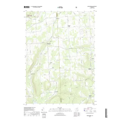
2019 Map of Mecklenburg
USGS Topo · Published 2019About this map
Finger Lakes National Forest occupies the northwestern corner of this landscape, where the boundary between Schuyler Co and Tompkins Co runs through a region of high ridges and deep inlets. The topography is defined by significant elevations like Connecticut Hill and Buck Hill, which overlook the headwaters of Cayuta Inlet and Taughannock Cr. Settlement patterns follow the historical road network, centering on small hubs such as Mecklenburg, Enfield, and Cayutaville. The area is notably dense with small family and community burial grounds, including the McIntyre Settlement Cem and Quaker Cem, providing a clear map of 19th-century pioneer legacy. In the southern portion, the N Country National Scenic Trail winds through the hills, while Culver Airfield serves as a modern landmark amidst the traditional farmsteads of Bostwick Corners and Trumbull Corners.
Find a feature on this map
60 named features on this map. Tap any name to fly to it.
Don’t see what you’re looking for? This feature index may not catch every label — zoom into the map to look around manually.
Map Details
Editions of this 2019 Mecklenburg Map
This is the sole edition of this map. No revisions or reprints were ever made.
Other maps of this area

1893 · Ithaca
USGS Topo · 1:62,500

1895 · Ithaca
USGS Topo · 1:62,500

1898 · Watkins Glen
USGS Topo · 1:62,500

1901 · Watkins
USGS Topo · 1:62,500

1902 · Genoa
USGS Topo · 1:62,500

1902 · Ovid
USGS Topo · 1:62,500

1905 · Watkins Glen
USGS Topo · 1:125,000

1942 · Ludlowville
USGS Topo · 1:24,000

1942 · Lodi
USGS Topo · 1:24,000

1942 · Trumansburg
USGS Topo · 1:24,000