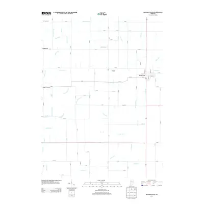
2013 Map of Medaryville
USGS Topo · Published 2013About this map
Medaryville serves as the primary population center in this corner of Pulaski County, where a grid of streets including W Main St and National St meets a landscape defined by an extensive drainage network. This 2013 survey illustrates a region heavily modified for agriculture, characterized by a complex system of artificial waterways such as Stump Slough Ditch, Hansell Ditch, and Selmer Ditch. These ditches, along with various named laterals and arms like the Rufus Rayburn Arm, suggest a long history of land reclamation to support the surrounding rural economy. Small settlements and named junctions like Asphaltum and Baileys Corner anchor the western reaches of the quadrangle. A notable concentration of small airfields, including Tatertown Airport, Antonian Airport, and the whimsically named Alley Oop Airport, points to the importance of private aviation in managing these large agricultural tracts.
Find a feature on this map
87 named features on this map. Tap any name to fly to it.
Don’t see what you’re looking for? This feature index may not catch every label — zoom into the map to look around manually.
Map Details
Editions of this 2013 Medaryville Map
This is the sole edition of this map. No revisions or reprints were ever made.
Other maps of this area

1953 · Chicago
USGS Topo · 1:250,000

1953 · Danville
USGS Topo · 1:250,000

1955 · Danville
USGS Topo · 1:250,000

1956 · Danville
USGS Topo · 1:250,000

1957 · Chicago
USGS Topo · 1:250,000

1957 · Wheatfield
USGS Topo · 1:24,000

1959 · North Judson
USGS Topo · 1:24,000

1959 · San Pierre
USGS Topo · 1:24,000

1962 · Monon NE
USGS Topo · 1:24,000

1962 · Medaryville
USGS Topo · 1:24,000