
1959 Map of North Judson
USGS Topo · Published 1961About this map
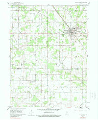
North Judson serves as the central hub of this 1959 landscape, where an exceptional concentration of rail infrastructure converges. No fewer than four major lines, including the Pennsylvania RR and the New York Central RR, intersect within the town limits, illustrating its historical importance as a Midwestern transportation junction. The surrounding terrain in Wayne and Rich Grove townships is defined by an extensive network of drainage projects, with family-named channels like Scholtz Ditch, Steffel Ditch, and Mc Cauliff Ditch reclaiming the land for agricultural use. Local community life is anchored by landmarks such as St Peters Sch, Liberty Sch, and the uniquely named Blue Sea Community Building. A small Landing Field and various Storage Bins further emphasize the mid-century intersection of aviation and industrial farming.
Find a feature on this map
44 named features on this map. Tap any name to fly to it.
Don’t see what you’re looking for? This feature index may not catch every label — zoom into the map to look around manually.
Map Details
Editions of this 1959 North Judson Map
2 editions found
Other maps of this area

1953 · Chicago
USGS Topo · 1:250,000

1957 · Chicago
USGS Topo · 1:250,000

1957 · Knox West
USGS Topo · 1:24,000

1958 · La Crosse
USGS Topo · 1:24,000

1959 · English Lake
USGS Topo · 1:24,000

1959 · San Pierre
USGS Topo · 1:24,000

1962 · Medaryville
USGS Topo · 1:24,000

1962 · Denham
USGS Topo · 1:24,000
1962 · Ripley
USGS Topo · 1:24,000
1962 · North Judson SE
USGS Topo · 1:24,000