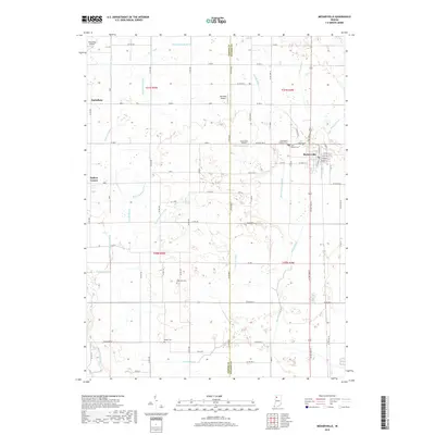
2019 Map of Medaryville
USGS Topo · Published 2019About this map
Medaryville stands as the primary population center on this landscape where Jasper and Pulaski counties meet in northwest Indiana. The terrain is defined by an extensive network of drainage infrastructure, such as Stump Ditch, Hansell Ditch, and Selmer Ditch, illustrating a long-standing history of land reclamation for agriculture. Small rural settlements like Asphaltum and Baileys Corner anchor the western reaches of the survey, while the local aviation history is surprisingly prominent for a rural quadrangle, evidenced by three distinct airfields: Alley Oop Airport, Antonian Airport, and Tatertown Airport. Genealogists will find several burial grounds across the area, including Saint Henrys Cem and Robinson Cem, which serve as quiet markers of the families who established these townships. The strictly gridded road system, featuring routes like Base Rd W and Co Rd 1500 W, underscores the systematic development of the Kankakee River basin region.
Find a feature on this map
79 named features on this map. Tap any name to fly to it.
Don’t see what you’re looking for? This feature index may not catch every label — zoom into the map to look around manually.
Map Details
Editions of this 2019 Medaryville Map
This is the sole edition of this map. No revisions or reprints were ever made.
Other maps of this area

1953 · Chicago
USGS Topo · 1:250,000

1953 · Danville
USGS Topo · 1:250,000

1955 · Danville
USGS Topo · 1:250,000

1956 · Danville
USGS Topo · 1:250,000

1957 · Chicago
USGS Topo · 1:250,000

1957 · Wheatfield
USGS Topo · 1:24,000

1959 · North Judson
USGS Topo · 1:24,000

1959 · San Pierre
USGS Topo · 1:24,000

1962 · Monon NE
USGS Topo · 1:24,000

1962 · Medaryville
USGS Topo · 1:24,000