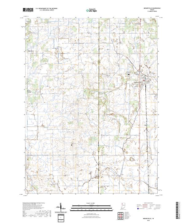
2022 Map of Medaryville
USGS Topo · Published 2022About this map
The town of Medaryville serves as the primary hub of this northwestern Indiana landscape, where the grid of modern agriculture is defined by an extensive drainage network. This intricate system of water management includes the Ryan Ditch, Stump Slough Ditch, and Gehring and Gumz Ditch, reflecting a long history of converting wetland into productive farmland. The area is dotted with small settlements like Asphaltum and Baileys Corner, while the presence of the Tatertown Airport and Alley Oop Airport suggests a reliance on small-scale aviation within this rural expanse.
Find a feature on this map
74 named features on this map. Tap any name to fly to it.
Don’t see what you’re looking for? This feature index may not catch every label — zoom into the map to look around manually.
Map Details
Editions of this 2022 Medaryville Map
This is the sole edition of this map. No revisions or reprints were ever made.
Other maps of this area

1953 · Chicago
USGS Topo · 1:250,000

1953 · Danville
USGS Topo · 1:250,000

1955 · Danville
USGS Topo · 1:250,000

1956 · Danville
USGS Topo · 1:250,000

1957 · Chicago
USGS Topo · 1:250,000

1957 · Wheatfield
USGS Topo · 1:24,000

1959 · North Judson
USGS Topo · 1:24,000

1959 · San Pierre
USGS Topo · 1:24,000

1962 · Monon NE
USGS Topo · 1:24,000

1962 · Medaryville
USGS Topo · 1:24,000