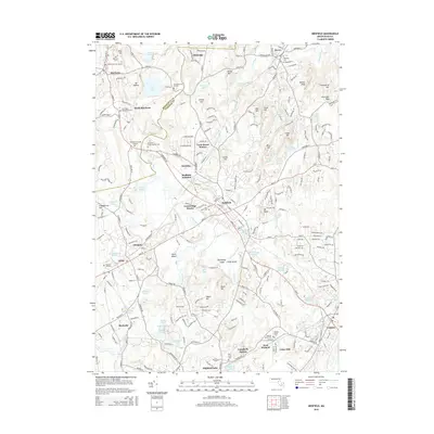
2015 Map of Medfield
USGS Topo · Published 2015About this map
The Charles River winds through the heart of this landscape, separating the communities of Sherborn, Millis, and Medfield. This 2015 data reflects a suburban-rural corridor defined by dense clusters of historical cemeteries and local landmarks. To the north, South Sherborn and Glenridge are framed by glacial terrain features like Mt Misery and Juniper Hill. Central to the map is the large campus of the Medfield State Hospital Cem, situated near the confluence of the river and N Brook. The transportation history of the region is evident in the rail network connecting points like Medfield Junction, Farm Street Station, and Campbells Station, which once linked these agricultural and early industrial towns to the broader Boston area. Significant open spaces like the Noon Hill and Noanet Peak areas suggest a preserved natural landscape interspersed with family-named burying grounds and small ponds such as Lymans Pond and Echo Lake.
Find a feature on this map
251 named features on this map. Tap any name to fly to it.
Don’t see what you’re looking for? This feature index may not catch every label — zoom into the map to look around manually.
Map Details
Editions of this 2015 Medfield Map
This is the sole edition of this map. No revisions or reprints were ever made.
Other maps of this area

1886 · Dedham
USGS Topo · 1:62,500

1886 · Framingham
USGS Topo · 1:62,500

1887 · Franklin
USGS Topo · 1:62,500

1889 · Franklin
USGS Topo · 1:62,500

1889 · Framingham
USGS Topo · 1:62,500

1893 · Franklin
USGS Topo · 1:62,500

1893 · Boston
USGS Topo · 1:62,500

1894 · Dedham
USGS Topo · 1:62,500

1894 · Framingham
USGS Topo · 1:62,500

1903 · Boston
USGS Topo · 1:62,500