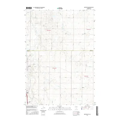
2016 Map of Medford East
USGS Topo · Published 2016About this map
The Straight River carves a path through the western half of this Steele County landscape, serving as a primary geographical anchor for the communities of Medford and Clinton Falls. The terrain is defined by a dense network of township roads and county highways that bridge the transition from the river valley to the agricultural uplands. To the east, the N Fork Zumbro River and Rush Cr drain the rolling countryside near the small settlement of Merton. For those researching local family history, several burial grounds are distributed across the quadrangle, including Union Cem, Richland Cem, and Oak Hill Cem. The southern edge of the map is marked by the Grand View Memorial Gardens, while the northern section is bounded by the line between Rice and Steele counties. The interplay of several distinct waterways, including Mud Cr and Medford Cr, illustrates the complex drainage patterns typical of this region's glaciated history.
Find a feature on this map
70 named features on this map. Tap any name to fly to it.
Don’t see what you’re looking for? This feature index may not catch every label — zoom into the map to look around manually.
Map Details
Editions of this 2016 Medford East Map
This is the sole edition of this map. No revisions or reprints were ever made.
Other maps of this area

1953 · Saint Paul
USGS Topo · 1:250,000

1959 · Saint Paul
USGS Topo · 1:250,000

1960 · Faribault
USGS Topo · 1:24,000

1960 · Cannon City
USGS Topo · 1:24,000

1960 · Nerstrand
USGS Topo · 1:24,000

1962 · Medford East
USGS Topo · 1:24,000

1962 · Owatonna
USGS Topo · 1:24,000

1962 · Moland
USGS Topo · 1:24,000

1962 · Owatonna SE
USGS Topo · 1:24,000

1962 · Saco
USGS Topo · 1:24,000