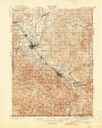
1978 Map of Medford
USGS Topo · Published 1994About this map
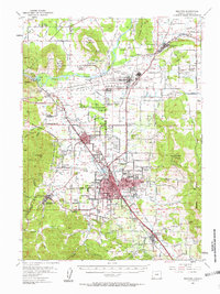
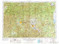
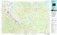
Medford and the Bear Creek Valley serve as the primary focus of this late-twentieth-century study, illustrating the urban corridor stretching through Phoenix, Talent, and Ashland. The landscape reveals a transition from these concentrated settlements into the managed timberlands and protected peaks of the Rogue River National Forest and Winema National Forest. The presence of the Southern Pacific railroad and the Medford-Jackson County Airport underscores the region's role as a transportation hub for southern Oregon. To the east, the map details a complex hydraulic network including Howard Prairie Lake and Hyatt Reservoir, alongside prominent landmarks like Mt McLoughlin and the volcanic terrain of the Lava flows. Small communities such as Sams Valley and White City dot the northern reaches, while the southern margin reaches the Oregon-California border, framed by the Siskiyou Mountains.
Find a feature on this map
60 named features on this map. Tap any name to fly to it.
Don’t see what you’re looking for? This feature index may not catch every label — zoom into the map to look around manually.
Map Details
Editions of this 1978 Medford Map
This is the sole edition of this map. No revisions or reprints were ever made.
Historical Maps of Medford Through Time
6 maps found