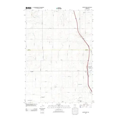
2013 Map of Medford West
USGS Topo · Published 2013About this map
Medford and the rural townships of the Rice Co Steele Co border appear here in 2013, defined by a landscape of productive agricultural grids and significant burial grounds. For genealogists, the map is remarkably detailed, documenting several small denominational and family plots including Norwegian Lutheran Meraker Cem, Trinity Cem, and Denison Cem. The drainage patterns of Mackenzie Cr and Mud Cr dictate the layout of these upland farms, while the Straight River creates a natural corridor through the east. Notable aviation features like the private Underland Airstrip and the northern edge of the Owatonna Degner Regional Airport show how modern transport infrastructure overlays the older rural networks of Deerfield. The presence of the Pelican Lake Bed in the southwest corner points to the region's glacial history and the conversion of former wetlands into arable farmland.
Find a feature on this map
54 named features on this map. Tap any name to fly to it.
Don’t see what you’re looking for? This feature index may not catch every label — zoom into the map to look around manually.
Map Details
Editions of this 2013 Medford West Map
This is the sole edition of this map. No revisions or reprints were ever made.
Other maps of this area

1953 · Saint Paul
USGS Topo · 1:250,000

1959 · Saint Paul
USGS Topo · 1:250,000

1960 · Faribault
USGS Topo · 1:24,000

1960 · Cannon City
USGS Topo · 1:24,000

1960 · Shieldsville
USGS Topo · 1:24,000

1962 · Medford East
USGS Topo · 1:24,000

1962 · Morristown
USGS Topo · 1:24,000

1962 · Owatonna
USGS Topo · 1:24,000

1962 · Saco
USGS Topo · 1:24,000

1962 · Meriden
USGS Topo · 1:24,000