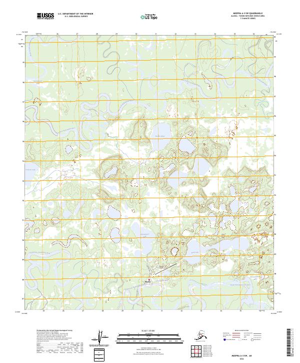
2024 Map of Medfra A-3 SW
USGS Topo · Published 2024About this map
The settlement of Nikolai serves as the focal point of this interior Alaska landscape, situated at the confluence of several significant waterways. The town's connection to the wider region is anchored by the Nikolai Airport and the historic Iditarod Trail, which traverses the southern portion of the sheet. The terrain is defined by a complex network of meandering rivers, including the North Fork Kuskokwim River, the East Fork Kuskokwim River, and the South Fork Kuskokwim River.
Find a feature on this map
20 named features on this map. Tap any name to fly to it.
Don’t see what you’re looking for? This feature index may not catch every label — zoom into the map to look around manually.
Map Details
Editions of this 2024 Medfra A-3 SW Map
This is the sole edition of this map. No revisions or reprints were ever made.
Other maps of this area

1949 · McGrath
USGS Topo · 1:250,000

1950 · Medfra
USGS Topo · 1:250,000

1950 · McGrath
USGS Topo · 1:250,000

1953 · McGrath D-4
USGS Topo · 1:63,360

1954 · McGrath D-3
USGS Topo · 1:63,360

1954 · Medfra A-3
USGS Topo · 1:63,360

1958 · McGrath
USGS Topo · 1:250,000
1959 · Medfra A-4
USGS Topo · 1:63,360

1959 · Medfra
USGS Topo · 1:250,000
2019 · McGrath D-4 NE
USGS Topo · 1:25,000