
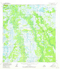
1953 Map of McGrath D-4
USGS Topo · Published 1963About this map
The Kuskokwim River serves as the primary hydrological anchor for this interior Alaskan wilderness, as seen in this 1953 survey. The landscape is defined by the complex, meandering paths of the Middle Fork Big River and the Pitka Fork, illustrating a drainage system characterized by intricate oxbows and seasonal swamp lands. Evidence of human activity is sparse but vital, centered around the Big River Roadhouse (Site) and the Farewell Landing, which likely served as crucial stopovers for river travel or seasonal expeditions. A Landing Strip and a Winter Trail represent the seasonal nature of transportation in this environment, where movement relied heavily on frozen routes or aerial access. Small structures, such as a solitary Cabin along the Salmon River, underscore the isolation of the region during the mid-20th century.
Find a feature on this map
14 named features on this map. Tap any name to fly to it.
Don’t see what you’re looking for? This feature index may not catch every label — zoom into the map to look around manually.
Map Details
Editions of this 1953 McGrath D-4 Map
2 editions found
Other maps of this area

1949 · McGrath
USGS Topo · 1:250,000

1950 · Medfra
USGS Topo · 1:250,000

1950 · McGrath
USGS Topo · 1:250,000

1953 · McGrath D-5
USGS Topo · 1:63,360

1953 · McGrath C-4
USGS Topo · 1:63,360

1954 · Medfra A-5
USGS Topo · 1:63,360

1954 · McGrath D-3
USGS Topo · 1:63,360

1954 · McGrath C-3
USGS Topo · 1:63,360

1954 · Medfra A-3
USGS Topo · 1:63,360
1955 · McGrath C-5
USGS Topo · 1:63,360