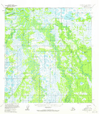
1953 Map of McGrath D-4
USGS Topo · Published 1972About this map
The Kuskokwim River dominates this interior Alaskan landscape, where the meandering Big River, Middle Fork, and Pitka Fork create a complex network of waterways and oxbow lakes. This 1953 survey captures the area’s reliance on seasonal travel and early aviation, centered around the Landing Strip and Farewell Landing in the northern portion of the quadrangle. Human presence is sparse but concentrated near the riverbanks, evidenced by the Big River Roadhouse (Site) and a nearby Cem.
Find a feature on this map
17 named features on this map. Tap any name to fly to it.
Don’t see what you’re looking for? This feature index may not catch every label — zoom into the map to look around manually.
Map Details
Editions of this 1953 McGrath D-4 Map
2 editions found
Other maps of this area

1949 · McGrath
USGS Topo · 1:250,000

1950 · Medfra
USGS Topo · 1:250,000

1950 · McGrath
USGS Topo · 1:250,000

1953 · McGrath D-5
USGS Topo · 1:63,360

1953 · McGrath C-4
USGS Topo · 1:63,360

1953 · McGrath D-4
USGS Topo · 1:63,360

1954 · Medfra A-5
USGS Topo · 1:63,360

1954 · McGrath D-3
USGS Topo · 1:63,360

1954 · McGrath C-3
USGS Topo · 1:63,360

1954 · Medfra A-3
USGS Topo · 1:63,360