
1953 Map of McGrath C-4
USGS Topo · Published 1963About this map
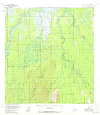
Kuskokwim River headwaters define this subarctic landscape during the early 1950s, where the drainage systems of the Big River and Middle Fork converge. The topography is dominated by expansive wetlands and meandering waterways, a characteristic river-and-marsh environment where the Windy Fork joins the larger system. This 1953 field-annotated survey captures the untouched character of the interior before modern development, as seen by the complete absence of roads or trails across the terrain. Rising from the low-lying plains, Lone Mountain stands as the primary landmark in the southern portion of the quadrangle, overlooking the winding path of Kluwebofnik Creek. The map provides a detailed record of the shifting channels and seasonal bogs that dictate movement through this part of the Alaskan interior, serving as a baseline for environmental and geological study of the region.
Find a feature on this map
6 named features on this map. Tap any name to fly to it.
Don’t see what you’re looking for? This feature index may not catch every label — zoom into the map to look around manually.
Map Details
Editions of this 1953 McGrath C-4 Map
2 editions found
Other maps of this area

1949 · McGrath
USGS Topo · 1:250,000

1950 · McGrath
USGS Topo · 1:250,000

1953 · McGrath D-5
USGS Topo · 1:63,360

1953 · McGrath D-4
USGS Topo · 1:63,360

1954 · McGrath B-4
USGS Topo · 1:63,360

1954 · McGrath D-3
USGS Topo · 1:63,360

1954 · McGrath C-3
USGS Topo · 1:63,360

1954 · McGrath B-5
USGS Topo · 1:63,360
1955 · McGrath C-5
USGS Topo · 1:63,360
1958 · McGrath B-3
USGS Topo · 1:63,360