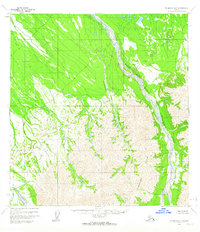
1958 Map of McGrath B-3
USGS Topo · Published 1964About this map
Windy Fork Middle Fork Kuskokwim River defines the drainage patterns of this Alaskan interior landscape, where braided river channels and shifting sandbars dominate the valley floor. To the south, the Trimokish Hills rise sharply from the lowlands, providing a clear boundary between the flat riparian corridors and the more elevated, complex topography of the region. The map reflects a mid-century period when the Middle Fork Kuskokwim River and its various tributaries, such as Khuchaynik Creek, remained largely roadless and untouched by modern infrastructure. This 1958 field-annotated survey, based on aerial photography from the early to mid-1950s, offers a detailed look at the natural hydrology of the Yukon-Koyukuk region before any significant human development altered its character.
Find a feature on this map
4 named features on this map. Tap any name to fly to it.
Don’t see what you’re looking for? This feature index may not catch every label — zoom into the map to look around manually.
Map Details
Editions of this 1958 McGrath B-3 Map
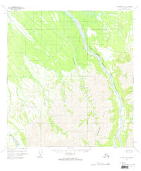
2 editions found
Other maps of this area

1949 · McGrath
USGS Topo · 1:250,000

1950 · McGrath
USGS Topo · 1:250,000

1953 · McGrath C-4
USGS Topo · 1:63,360

1954 · McGrath B-4
USGS Topo · 1:63,360

1954 · McGrath A-4
USGS Topo · 1:63,360

1954 · McGrath C-3
USGS Topo · 1:63,360

1958 · McGrath A-2
USGS Topo · 1:63,360

1958 · McGrath B-2
USGS Topo · 1:63,360

1958 · McGrath A-3
USGS Topo · 1:63,360

1958 · McGrath C-2
USGS Topo · 1:63,360