
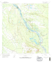
1958 Map of McGrath C-2
USGS Topo · Published 1964About this map
The South Fork Kuskokwim River dominates this interior Alaska landscape, weaving a braided path northward through a region defined by its reliance on remote transport networks. The area around Farewell Lake serves as a small hub of activity, featuring the Farewell Lake Lodge and a nearby Landing Strip. To the southwest, aviation and communications infrastructure is anchored by the Farewell Airport, accompanied by Radio Towers and a Beacon.
Find a feature on this map
19 named features on this map. Tap any name to fly to it.
Don’t see what you’re looking for? This feature index may not catch every label — zoom into the map to look around manually.
Map Details
Editions of this 1958 McGrath C-2 Map
2 editions found
Other maps of this area

1949 · McGrath
USGS Topo · 1:250,000

1950 · McGrath
USGS Topo · 1:250,000

1954 · McGrath D-3
USGS Topo · 1:63,360

1954 · McGrath C-3
USGS Topo · 1:63,360

1958 · McGrath B-1
USGS Topo · 1:63,360

1958 · McGrath B-2
USGS Topo · 1:63,360

1958 · McGrath D-2
USGS Topo · 1:63,360

1958 · McGrath C-1
USGS Topo · 1:63,360
1958 · McGrath B-3
USGS Topo · 1:63,360

1958 · McGrath D-1
USGS Topo · 1:63,360