
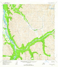
1958 Map of McGrath B-1
USGS Topo · Published 1963About this map
The South Fork Kuskokwim River and Tatina River converge within a landscape dominated by the high peaks of the Teocalli Mountains and Terra Cotta Mountains. This 1950s era survey captures a remote interior Alaskan environment where human presence is sparse, marked primarily by a cluster of Cabins and an adjacent Landing Strip near the confluence of the Tatina and Lynx Creek. The drainage patterns are intricate, with the Jones River and Automatic Creek feeding the primary waterways from the north.
Find a feature on this map
13 named features on this map. Tap any name to fly to it.
Don’t see what you’re looking for? This feature index may not catch every label — zoom into the map to look around manually.
Map Details
Editions of this 1958 McGrath B-1 Map
2 editions found
Other maps of this area

1949 · McGrath
USGS Topo · 1:250,000

1950 · McGrath
USGS Topo · 1:250,000

1950 · Talkeetna
USGS Topo · 1:250,000

1951 · Talkeetna
USGS Topo · 1:250,000

1958 · Talkeetna A-6
USGS Topo · 1:63,360

1958 · Talkeetna B-6
USGS Topo · 1:63,360

1958 · Talkeetna C-6
USGS Topo · 1:63,360

1958 · McGrath A-2
USGS Topo · 1:63,360

1958 · McGrath A-1
USGS Topo · 1:63,360

1958 · McGrath B-2
USGS Topo · 1:63,360