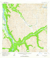
1958 Map of McGrath B-1
USGS Topo · Published 1963About this map
The South Fork Kuskokwim River dominates the western corridor of this interior Alaskan landscape, where the Terra Cotta Mountains and Teocalli Mountains rise sharply from the river valleys. A small cluster of Cabins and a nearby Landing Strip situated at a river bend indicate the vital role of bush aviation and seasonal residency in this wilderness during the late 1950s. The drainage network is dense and complex, with the Tatina River and Jones River cutting deep through the high relief. Other watercourses like Post River, Earl River, and Automatio Creek provide a clear view of the area's natural topography before modern development or infrastructure reached this part of the Yukon-Koyukuk region.
Find a feature on this map
13 named features on this map. Tap any name to fly to it.
Don’t see what you’re looking for? This feature index may not catch every label — zoom into the map to look around manually.
Map Details
Editions of this 1958 McGrath B-1 Map
2 editions found
Other maps of this area

1949 · McGrath
USGS Topo · 1:250,000

1950 · McGrath
USGS Topo · 1:250,000

1950 · Talkeetna
USGS Topo · 1:250,000

1951 · Talkeetna
USGS Topo · 1:250,000

1958 · Talkeetna A-6
USGS Topo · 1:63,360

1958 · Talkeetna B-6
USGS Topo · 1:63,360

1958 · Talkeetna C-6
USGS Topo · 1:63,360

1958 · McGrath B-1
USGS Topo · 1:63,360

1958 · McGrath A-2
USGS Topo · 1:63,360

1958 · McGrath A-1
USGS Topo · 1:63,360