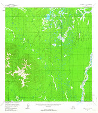
1955 Map of McGrath C-5
USGS Topo · Published 1963About this map
Big River dominates the eastern landscape of this interior Alaska region, winding through a complex network of wetlands and low-relief terrain. Surveyed in the mid-1950s using photogrammetric methods from aerial photographs, the map reveals a wilderness largely devoid of human infrastructure, defined instead by its hydrological patterns. The Katlitna River and Blackwater Creek snake through the central and western portions of the quadrangle, illustrating the intricate drainage systems common to this part of the Seward Meridian. In the southwest, the Little Selatna River marks the transition into higher elevations where more pronounced topographic contours emerge. This survey, which was not field checked at the time of its initial release, provides a foundational look at the unsurveyed and unmarked locations predetermined by the Bureau of Land Management for the McGrath district.
Find a feature on this map
4 named features on this map. Tap any name to fly to it.
Don’t see what you’re looking for? This feature index may not catch every label — zoom into the map to look around manually.
Map Details
Editions of this 1955 McGrath C-5 Map
2 editions found
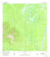
Other maps of this area

1949 · McGrath
USGS Topo · 1:250,000

1950 · McGrath
USGS Topo · 1:250,000

1953 · McGrath D-5
USGS Topo · 1:63,360

1953 · McGrath C-4
USGS Topo · 1:63,360

1953 · McGrath D-4
USGS Topo · 1:63,360

1954 · McGrath D-6
USGS Topo · 1:63,360

1954 · McGrath B-4
USGS Topo · 1:63,360

1954 · McGrath B-6
USGS Topo · 1:63,360

1954 · McGrath C-6
USGS Topo · 1:63,360

1954 · McGrath B-5
USGS Topo · 1:63,360