
1954 Map of McGrath C-6
USGS Topo · Published 1963About this map
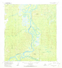
The Kuskokwim River serves as the central artery through this Alaskan interior landscape, winding past the landmark height of Vinasale Mountain. Based on aerial photography from the early to mid-1950s, the map illustrates a complex fluvial system where the main channel meets the Black River and Selatna River, creating numerous sloughs and islands. At the southern bend of the Kuskokwim, the Nunivak Bar sits near the base of Selatna Mountain, marking a point of geological significance for river navigation. The area around Vinasale reflects the sparse settlement patterns and heavy reliance on waterways characteristic of the Yukon-Koyukuk region during the post-war era. This survey provides an essential view of the hydrography before any modern development, documenting the natural state of Butcher Creek and the Little River as they drain into the Kuskokwim basin.
Find a feature on this map
9 named features on this map. Tap any name to fly to it.
Don’t see what you’re looking for? This feature index may not catch every label — zoom into the map to look around manually.
Map Details
Editions of this 1954 McGrath C-6 Map
2 editions found
Other maps of this area

1949 · McGrath
USGS Topo · 1:250,000

1950 · McGrath
USGS Topo · 1:250,000

1951 · Iditarod
USGS Topo · 1:250,000

1953 · McGrath D-5
USGS Topo · 1:63,360

1954 · McGrath D-6
USGS Topo · 1:63,360

1954 · Iditarod B-1
USGS Topo · 1:63,360

1954 · McGrath B-6
USGS Topo · 1:63,360

1954 · McGrath B-5
USGS Topo · 1:63,360
1954 · Iditarod D-1
USGS Topo · 1:63,360
1955 · Iditarod D-1
USGS Topo · 1:63,360