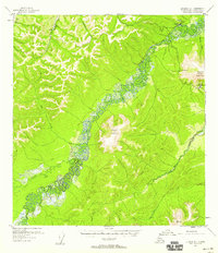
1955 Map of Iditarod D-1
USGS Topo · Published 1958About this map
The Takotna River winds through the interior of Alaska's Fourth Judicial Division, defining the valley's drainage and transport patterns during the mid-1950s. The settlement of Takotna sits at the northeastern edge of this map, supported by an adjacent Airstrip and the nearby Takotna Air Force Station on Takotna Mountain. This region was an active corridor for resource extraction, evidenced by a Placer Mine near Independence Creek and a network of cabins connected by a Winter Trail that cuts across the western muskeg and hills. The landscape is dominated by significant elevations such as Mount Joaquin, while smaller tributaries like Yankee Creek and Fourth of July Creek feed the main river system. This survey documents the intersection of military presence and early mining interests before later development reshaped the Alaskan interior.
Find a feature on this map
17 named features on this map. Tap any name to fly to it.
Don’t see what you’re looking for? This feature index may not catch every label — zoom into the map to look around manually.
Map Details
Editions of this 1955 Iditarod D-1 Map
This is the sole edition of this map. No revisions or reprints were ever made.
Other maps of this area

1949 · McGrath
USGS Topo · 1:250,000

1950 · Medfra
USGS Topo · 1:250,000

1950 · McGrath
USGS Topo · 1:250,000

1951 · Ophir
USGS Topo · 1:250,000

1951 · Iditarod
USGS Topo · 1:250,000

1954 · Medfra A-6
USGS Topo · 1:63,360

1954 · Ophir A-2
USGS Topo · 1:63,360

1954 · McGrath D-6
USGS Topo · 1:63,360

1954 · Ophir A-1
USGS Topo · 1:63,360

1954 · McGrath C-6
USGS Topo · 1:63,360