
1954 Map of Medfra A-6
USGS Topo · Published 1958About this map
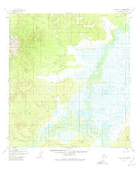
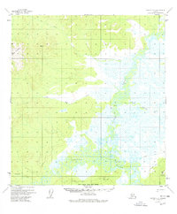
The Takotna River meanders through a low-lying basin of wetlands and oxbow lakes in this mid-century survey of the Alaska interior. This landscape is defined by the complex water systems of The Forks and the marshy reaches surrounding Hook Lake. To the west and south, the terrain rises sharply toward the peaks of Cloudy Mountain and the heights of Porcupine Ridge, while Appel Mountain stands as a prominent landmark in the southeast corner.
Find a feature on this map
10 named features on this map. Tap any name to fly to it.
Don’t see what you’re looking for? This feature index may not catch every label — zoom into the map to look around manually.
Map Details
Editions of this 1954 Medfra A-6 Map
3 editions found
Other maps of this area

1949 · McGrath
USGS Topo · 1:250,000

1950 · Medfra
USGS Topo · 1:250,000

1950 · McGrath
USGS Topo · 1:250,000

1951 · Ophir
USGS Topo · 1:250,000

1951 · Iditarod
USGS Topo · 1:250,000

1953 · McGrath D-5
USGS Topo · 1:63,360

1953 · Medfra B-5
USGS Topo · 1:63,360

1954 · McGrath D-6
USGS Topo · 1:63,360

1954 · Medfra A-5
USGS Topo · 1:63,360

1954 · Ophir A-1
USGS Topo · 1:63,360