
1953 Map of Medfra B-5
USGS Topo · Published 1964About this map
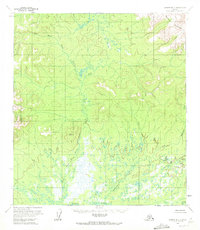
Nixon Fork and the Nixon River dominate this interior Alaska landscape, defining a complex drainage system across unsurveyed lands. The terrain transitions from the low-lying wet areas and swamps along Washington Creek to the rising elevations of the Sunshine Mountains in the northeast corner. This 1953 field annotation captures a wilderness prior to any established road network or permanent settlements, where the river system served as the primary geographic framework. The mapping reveals the intricate meandering of the West Fork Nixon River, illustrating the slow movement of water through the low-relief valleys of the Yukon-Koyukuk region. These land lines represent predetermined but unmarked locations according to the Bureau of Land Management, reflecting a period of bureaucratic organization in an physically unmapped territory.
Find a feature on this map
6 named features on this map. Tap any name to fly to it.
Don’t see what you’re looking for? This feature index may not catch every label — zoom into the map to look around manually.
Map Details
Editions of this 1953 Medfra B-5 Map
2 editions found
Other maps of this area

1950 · Medfra
USGS Topo · 1:250,000

1953 · Medfra B-4
USGS Topo · 1:63,360

1953 · Medfra C-4
USGS Topo · 1:63,360

1954 · Medfra A-6
USGS Topo · 1:63,360

1954 · Medfra A-5
USGS Topo · 1:63,360

1954 · Medfra C-6
USGS Topo · 1:63,360

1954 · Medfra C-5
USGS Topo · 1:63,360

1954 · Medfra B-6
USGS Topo · 1:63,360
1959 · Medfra A-4
USGS Topo · 1:63,360

1959 · Medfra
USGS Topo · 1:250,000