
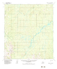
1954 Map of Medfra C-6
USGS Topo · Published 1963About this map
The North Fork Innoko River and the meandering Susulatna River dominate this interior Alaska landscape, reflecting a remote wilderness during the mid-1950s. The region is marked by a network of drainage systems, including Colorado Creek, Creston Creek, and Cripple Creek, which flow from high points such as VABM Cripple 3272. Human presence in this isolated terrain is limited to essential survival and industrial infrastructure, most notably the Colorado Creek Mine Landing Strip. A seasonal Summer Trail provides the primary overland route through the northern section of the quadrangle, passing near a solitary Cabin. These features suggest an era of mineral exploration and bush aviation, where transport depended heavily on river valleys and small landing sites in the shadow of the Mountains.
Find a feature on this map
18 named features on this map. Tap any name to fly to it.
Don’t see what you’re looking for? This feature index may not catch every label — zoom into the map to look around manually.
Map Details
Editions of this 1954 Medfra C-6 Map
3 editions found
Other maps of this area

1950 · Medfra
USGS Topo · 1:250,000

1951 · Ophir
USGS Topo · 1:250,000

1953 · Medfra B-5
USGS Topo · 1:63,360

1954 · Medfra C-5
USGS Topo · 1:63,360

1954 · Medfra D-5
USGS Topo · 1:63,360

1954 · Medfra D-6
USGS Topo · 1:63,360

1954 · Medfra B-6
USGS Topo · 1:63,360
1954 · Ophir D-1
USGS Topo · 1:63,360

1954 · Ophir C-1
USGS Topo · 1:63,360

1954 · Ophir B-1
USGS Topo · 1:63,360