
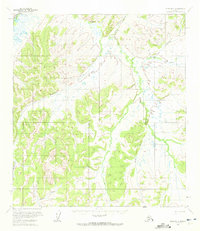
1954 Map of Ophir B-1
USGS Topo · Published 1965About this map
Folger marks a remote outpost along the Innoko River in the Alaskan interior during the mid-1950s. This survey, based on aerial photographs taken in 1954 and 1955, documents a landscape defined by an intricate network of waterways and seasonal overland routes. The Summer Trail provides a rare terrestrial link through the drainages of Butte Creek and Folger Creek, while a lonely Cabin is recorded further south near the headwaters of Dominion Creek. The drainage patterns are meticulously mapped, showing the relationship between the main river and its tributaries like Kimbley Creek, Canyon Creek, and the South Fork Folger Creek. The map reflects an era when the Bureau of Land Management was predetermining land lines for unsurveyed territory, illustrating the frontier character of the Yukon-Koyukuk region before more modern infrastructure arrived.
Find a feature on this map
12 named features on this map. Tap any name to fly to it.
Don’t see what you’re looking for? This feature index may not catch every label — zoom into the map to look around manually.
Map Details
Editions of this 1954 Ophir B-1 Map
2 editions found
Other maps of this area

1950 · Medfra
USGS Topo · 1:250,000

1951 · Ophir
USGS Topo · 1:250,000

1954 · Medfra A-6
USGS Topo · 1:63,360

1954 · Ophir A-2
USGS Topo · 1:63,360

1954 · Ophir A-1
USGS Topo · 1:63,360

1954 · Medfra C-6
USGS Topo · 1:63,360

1954 · Medfra B-6
USGS Topo · 1:63,360

1954 · Ophir C-1
USGS Topo · 1:63,360

1954 · Ophir C-2
USGS Topo · 1:63,360

1954 · Ophir B-2
USGS Topo · 1:63,360