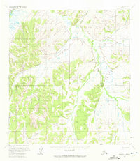
1954 Map of Ophir B-1
USGS Topo · Published 1972About this map
Folger and Dominion represent the sparse human footprint in this interior Alaskan landscape as it appeared in the mid-1950s. The terrain is defined by a dense network of drainages, including Butte Creek, Kimbley Creek, and Canyon Creek, which flow through territory that remained largely unsurveyed and unmarked on the ground at the time of mapping. A significant Summer Trail provides a rare terrestrial route through the high ground, connecting remote drainages such as Folger Creek and Warner Creek. This survey captures the region just before the era of modern development, showing a wilderness where travel was dictated by seasonal trails and the natural corridors created by Dominion Creek and the South Fork. The map reflects a moment when the Bureau of Land Management was still predetermining land lines for this vast, unnamed portion of the Kateel River Meridian.
Find a feature on this map
11 named features on this map. Tap any name to fly to it.
Don’t see what you’re looking for? This feature index may not catch every label — zoom into the map to look around manually.
Map Details
Editions of this 1954 Ophir B-1 Map
2 editions found
Other maps of this area

1950 · Medfra
USGS Topo · 1:250,000

1951 · Ophir
USGS Topo · 1:250,000

1954 · Medfra A-6
USGS Topo · 1:63,360

1954 · Ophir A-2
USGS Topo · 1:63,360

1954 · Ophir A-1
USGS Topo · 1:63,360

1954 · Medfra C-6
USGS Topo · 1:63,360

1954 · Medfra B-6
USGS Topo · 1:63,360

1954 · Ophir C-1
USGS Topo · 1:63,360

1954 · Ophir C-2
USGS Topo · 1:63,360

1954 · Ophir B-1
USGS Topo · 1:63,360