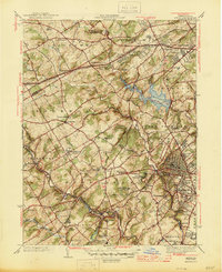
1945 Map of Media
USGS Topo · Published 1945About this map
Springton Reservoir dominates the center of this Delaware County landscape, which transitions from the organized streets of Media to the institutional campuses and agricultural tracts of the mid-1940s. The region is marked by several significant educational and social foundations, including the Sleighton Farm School, Elwyn Training School, and the Williamson Trade School. These large properties, alongside the extensive Tyler Arboretum, illustrate a pattern of land use where sizable estates and specialized schools remained intact as suburban growth began pressing outward from Philadelphia. Transport networks like the Pennsylvania railroad and the Blackhorse Cloverleaf show the infrastructure supporting this commuter corridor. Smaller settlements such as Newtown Square, Glen Riddle, and Lenni are visible alongside family-named landmarks like the Radnor Hunt Club and Drexel Lodge.
Find a feature on this map
87 named features on this map. Tap any name to fly to it.
Don’t see what you’re looking for? This feature index may not catch every label — zoom into the map to look around manually.
Map Details
Editions of this 1945 Media Map
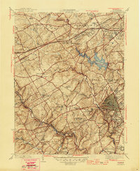
2 editions found
Other maps of this area

1894 · Chester
USGS Topo · 1:62,500

1894 · Norristown
USGS Topo · 1:62,500

1895 · Norristown
USGS Topo · 1:62,500

1896 · Norristown
USGS Topo · 1:62,500

1896 · Chester
USGS Topo · 1:62,500

1898 · Chester
USGS Topo · 1:62,500

1901 · Camden
USGS Topo · 1:125,000

1901 · West Chester
USGS Topo · 1:62,500

1904 · West Chester
USGS Topo · 1:62,500

1906 · Phoenixville
USGS Topo · 1:62,500
Featured Places
- Chester, PA
- Radnor Township, PA
- Marple Township, PA
- Upper Providence Township, PA
- Willistown Township, PA