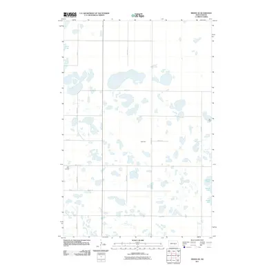
2011 Map of Medina SE
USGS Topo · Published 2011About this map
Saint Peters Cemetery sits along the western edge of this prairie landscape, serving as a significant genealogical marker for the rural community in Stutsman County. The terrain is defined by a dense concentration of small water bodies and wetlands typical of the Missouri Coteau region, including Stink Lake in the northwest and the larger School Lake to the southeast. Human activity is evidenced by the systematic grid of section roads like 52nd Ave SE and 43rd St SE, which provide access to scattered agricultural landmarks. Rau Field and Rueb Dam reflect the local land use and infrastructure that support the area's farming and ranching legacy. This 2011 survey captures the hydrological complexity of the North Dakota pothole region before modern drainage or consolidation might alter the footprint of these seasonal and permanent waters.
Find a feature on this map
15 named features on this map. Tap any name to fly to it.
Don’t see what you’re looking for? This feature index may not catch every label — zoom into the map to look around manually.
Map Details
Editions of this 2011 Medina SE Map
This is the sole edition of this map. No revisions or reprints were ever made.
Other maps of this area

1953 · Jamestown
USGS Topo · 1:250,000

1953 · Cleveland SW
USGS Topo · 1:24,000

1954 · Cleveland NW
USGS Topo · 1:24,000

1954 · Medina
USGS Topo · 1:24,000

1955 · Crystal Springs
USGS Topo · 1:24,000

1955 · Medina SW
USGS Topo · 1:24,000

1955 · Medina SE
USGS Topo · 1:24,000

1956 · Jamestown
USGS Topo · 1:250,000

1975 · Medina SW
USGS Topo · 1:24,000

1983 · Streeter
USGS Topo · 1:24,000