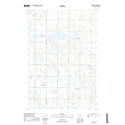
2020 Map of Medina SE
USGS Topo · Published 2020About this map
The Missouri Coteau landscape of Stutsman County is defined here by a dense concentration of glacial prairie potholes and seasonal wetlands. This 2020 survey illustrates a sparsely populated agricultural region structured by the Public Land Survey System, with township lines like t139n r69w and t138n r69w dividing the terrain into a regular grid of sections. The transportation network is almost entirely composed of section-line roads such as 40th St SE and 54th Ave SE, which navigate around the numerous small water bodies that dominate the surface.
Find a feature on this map
18 named features on this map. Tap any name to fly to it.
Don’t see what you’re looking for? This feature index may not catch every label — zoom into the map to look around manually.
Map Details
Editions of this 2020 Medina SE Map
This is the sole edition of this map. No revisions or reprints were ever made.
Other maps of this area

1953 · Jamestown
USGS Topo · 1:250,000

1953 · Cleveland SW
USGS Topo · 1:24,000

1954 · Cleveland NW
USGS Topo · 1:24,000

1954 · Medina
USGS Topo · 1:24,000

1955 · Crystal Springs
USGS Topo · 1:24,000

1955 · Medina SW
USGS Topo · 1:24,000

1955 · Medina SE
USGS Topo · 1:24,000

1956 · Jamestown
USGS Topo · 1:250,000

1975 · Medina SW
USGS Topo · 1:24,000

1983 · Streeter
USGS Topo · 1:24,000