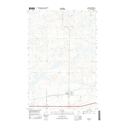
2014 Map of Medina
USGS Topo · Published 2014About this map
Medina serves as the central hub of this prairie landscape, with its residential streets organized around core routes like State St Nw and Water St E. The town's layout reflects a classic Midwestern grid, anchored by community landmarks such as School St Se and the nearby Saint Marys Cem to the southeast. This 2014 survey documents a region defined by an extensive network of depressions and small water bodies characteristic of the Missouri Coteau. Transport is dominated by the modern corridor of I-94, which cuts across the southern portion of the map, while local travel relies on a strictly rectilinear system of section-line roads like 55th Ave Se and 30th St Se. The map captures the specialized agricultural infrastructure of Stutsman County, showing how local traffic is funneled through Cr-68 and various named avenues that connect the scattered farmsteads of the surrounding plains.
Find a feature on this map
25 named features on this map. Tap any name to fly to it.
Don’t see what you’re looking for? This feature index may not catch every label — zoom into the map to look around manually.
Map Details
Editions of this 2014 Medina Map
This is the sole edition of this map. No revisions or reprints were ever made.
Other maps of this area

1952 · New Rockford
USGS Topo · 1:250,000

1953 · Jamestown
USGS Topo · 1:250,000

1953 · Cleveland SW
USGS Topo · 1:24,000

1954 · Cleveland NW
USGS Topo · 1:24,000

1954 · Medina
USGS Topo · 1:24,000

1955 · Crystal Springs
USGS Topo · 1:24,000

1955 · Medina SW
USGS Topo · 1:24,000

1955 · Medina SE
USGS Topo · 1:24,000

1956 · New Rockford
USGS Topo · 1:250,000

1956 · Jamestown
USGS Topo · 1:250,000