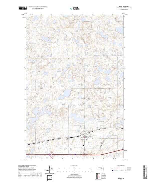
2024 Map of Medina
USGS Topo · Published 2024About this map
Medina serves as the primary hub of this eastern North Dakota prairie landscape, where the town grid is defined by streets like Np St Nw and Water St W. The area is characterized by a high density of small wetlands and glacial potholes, many of which are protected within the fragmented boundaries of the Stutsman County Waterfowl Production Area. This conservation patchwork illustrates the modern preservation of the Missouri Coteau's natural hydrology alongside traditional agricultural section lines. For local historians and genealogists, the map provides precise locations for Medina Cem and Saint Marys Cem, situated on the town's southern and eastern outskirts. The road network, including Co Rd 39 and various numbered section line roads like 55th Ave SE, highlights the enduring importance of the township and range survey system in organizing this rural landscape.
Find a feature on this map
33 named features on this map. Tap any name to fly to it.
Don’t see what you’re looking for? This feature index may not catch every label — zoom into the map to look around manually.
Map Details
Editions of this 2024 Medina Map
This is the sole edition of this map. No revisions or reprints were ever made.
Other maps of this area

1952 · New Rockford
USGS Topo · 1:250,000

1953 · Jamestown
USGS Topo · 1:250,000

1953 · Cleveland SW
USGS Topo · 1:24,000

1954 · Cleveland NW
USGS Topo · 1:24,000

1954 · Medina
USGS Topo · 1:24,000

1955 · Crystal Springs
USGS Topo · 1:24,000

1955 · Medina SW
USGS Topo · 1:24,000

1955 · Medina SE
USGS Topo · 1:24,000

1956 · New Rockford
USGS Topo · 1:250,000

1956 · Jamestown
USGS Topo · 1:250,000