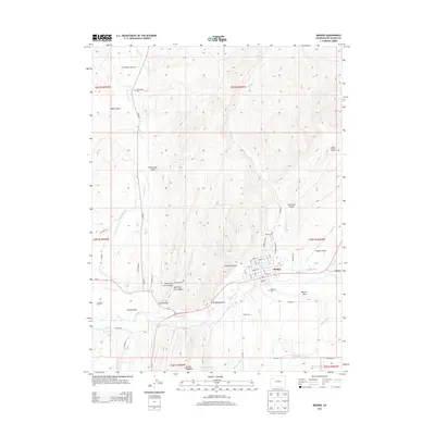
2013 Map of Meeker
USGS Topo · Published 2013About this map
The White River valley anchors this 2013 survey of the area around Meeker, Rio Blanco County, where the town's street grid reflects its role as a regional hub. To the west, the label for the Meeker Massacre site marks a significant location in the conflict between the White River Ute people and early settlers. The complex irrigation network of the valley is highly visible, featuring the Niblock Ditch, Meeker Ditch, and Highland Ditch, which redirect water to the agricultural lands of Powell Park and Agency Park. The terrain is defined by the striking ridge of the Grand Hogback in the south and numerous drainages like Strawberry Cr and Sulphur Cr that cut through the surrounding uplands. Local history is further preserved at Highland Cem and the Strawberry Cem, while the Meeker Airport north of the river indicates modern infrastructure serving this mountain valley community.
Find a feature on this map
62 named features on this map. Tap any name to fly to it.
Don’t see what you’re looking for? This feature index may not catch every label — zoom into the map to look around manually.
Map Details
Editions of this 2013 Meeker Map
This is the sole edition of this map. No revisions or reprints were ever made.
Other maps of this area

1906 · Grand Hogback
USGS Topo · 1:125,000

1907 · White River
USGS Topo · 1:125,000

1910 · Danforth Hills
USGS Topo · 1:125,000

1910 · Grand Hogback
USGS Topo · 1:125,000

1910 · White River
USGS Topo · 1:125,000

1912 · Meeker
USGS Topo · 1:62,500

1914 · Meeker
USGS Topo · 1:62,500

1952 · Segar Mountain
USGS Topo · 1:24,000

1954 · Vernal
USGS Topo · 1:250,000

1954 · Craig
USGS Topo · 1:250,000