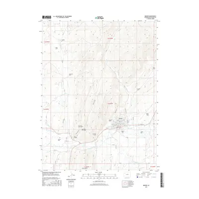
2016 Map of Meeker
USGS Topo · Published 2016About this map
Meeker serves as the focal point of this Northwest Colorado landscape, where the White River provides the vital water source for an extensive network of irrigation infrastructure. Tracing the river corridor reveals numerous engineered waterways such as the Meeker Ditch, Powell Park Ditch, and Highland Ditch, which support the agricultural pocket of Powell Park. The topography is dominated by the striking geologic formation of the Grand Hogback to the south and a series of deep drainages including Lion Canyon and Anderson Gulch. Local heritage is anchored by sites like Strawberry Creek Cem and Highland Cem, while the grid of Meeker itself shows a developed street plan from Garfield St to Water St. To the east, Meeker Coulter Field and Agency Park mark the transition toward the higher terrain of the White River valley.
Find a feature on this map
69 named features on this map. Tap any name to fly to it.
Don’t see what you’re looking for? This feature index may not catch every label — zoom into the map to look around manually.
Map Details
Editions of this 2016 Meeker Map
This is the sole edition of this map. No revisions or reprints were ever made.
Other maps of this area

1906 · Grand Hogback
USGS Topo · 1:125,000

1907 · White River
USGS Topo · 1:125,000

1910 · Danforth Hills
USGS Topo · 1:125,000

1910 · Grand Hogback
USGS Topo · 1:125,000

1910 · White River
USGS Topo · 1:125,000

1912 · Meeker
USGS Topo · 1:62,500

1914 · Meeker
USGS Topo · 1:62,500

1952 · Segar Mountain
USGS Topo · 1:24,000

1954 · Vernal
USGS Topo · 1:250,000

1954 · Craig
USGS Topo · 1:250,000