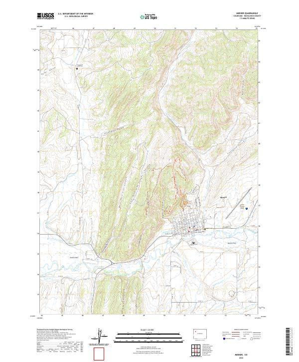
2022 Map of Meeker
USGS Topo · Published 2022About this map
The town of Meeker sits along the northern bank of the White River, serving as a central hub for this portion of Rio Blanco County. The landscape is defined by the striking ridge of the Grand Hogback, which separates the river valley from the deep drainages of West Fork Lion Canyon and East Fork Lion Canyon to the north. This survey illustrates a highly developed irrigation network essential for ranching and agriculture in the high desert, featuring the Powell Park Ditch, Meeker Ditch, and Highland Ditch. Local history and genealogy are anchored by two distinct burial grounds: Strawberry Creek Cem in the northern hills and Highland Cem overlooking the river valley. The map also detail the expanding Meeker Trail System-Trl, including the China Wall Trl and East Ridge Trl, which navigate the steep terrain surrounding the town.
Find a feature on this map
62 named features on this map. Tap any name to fly to it.
Don’t see what you’re looking for? This feature index may not catch every label — zoom into the map to look around manually.
Map Details
Editions of this 2022 Meeker Map
This is the sole edition of this map. No revisions or reprints were ever made.
Other maps of this area

1906 · Grand Hogback
USGS Topo · 1:125,000

1907 · White River
USGS Topo · 1:125,000

1910 · Danforth Hills
USGS Topo · 1:125,000

1910 · Grand Hogback
USGS Topo · 1:125,000

1910 · White River
USGS Topo · 1:125,000

1912 · Meeker
USGS Topo · 1:62,500

1914 · Meeker
USGS Topo · 1:62,500

1952 · Segar Mountain
USGS Topo · 1:24,000

1954 · Vernal
USGS Topo · 1:250,000

1954 · Craig
USGS Topo · 1:250,000