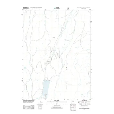
2012 Map of Meeks Cabin Reservoir
USGS Topo · Published 2012About this map
Meeks Cabin Reservoir dominates the southern landscape of this Uinta County region, where the Little W Fork Blacks Fork and Blacks Fork converge. The area serves as a focal point for high-altitude recreation and resource management, evidenced by the Meeks Cabin Campground and the Uinta County Youth Camp. A network of specialized routes, including the Blacks Fork Sheep Trl and various county roads like Co Rd-271, facilitates movement through the drainage basins of Fish Cr and Horse Cr. The presence of the Bigelow Ditch and Byrne Reservoir indicates the critical role of water diversion in this mountain terrain. From the secluded Van Tassel Lake to the north-flowing Evans Cr, the map illustrates a landscape defined by its riparian corridors and seasonal draws like Balsam Draw.
Find a feature on this map
27 named features on this map. Tap any name to fly to it.
Don’t see what you’re looking for? This feature index may not catch every label — zoom into the map to look around manually.
Map Details
Editions of this 2012 Meeks Cabin Reservoir Map
This is the sole edition of this map. No revisions or reprints were ever made.
Other maps of this area

1885 · Uinta
USGS Topo · 1:250,000

1901 · Hayden Peak
USGS Topo · 1:125,000

1903 · Hayden Peak
USGS Topo · 1:125,000

1905 · Gilbert Peak
USGS Topo · 1:125,000

1906 · Gilbert Peak
USGS Topo · 1:125,000

1954 · Salt Lake City
USGS Topo · 1:250,000

1954 · Ogden
USGS Topo · 1:250,000

1958 · Ogden
USGS Topo · 1:250,000

1958 · Salt Lake City
USGS Topo · 1:250,000

1960 · Ogden
USGS Topo · 1:250,000