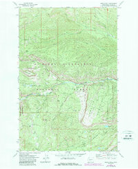
1971 Map of Meeks Table
USGS Topo · Published 1987About this map
Meeks Table dominates this high-elevation landscape in Yakima County, standing as a prominent geological landmark within the Mt Baker Snoqualmie National Forest. The 1970s topography reveals a complex network of drainages including Rattlesnake Creek, Nile Creek, and Devils Creek, which carve through the timbered heights. Much of the western portion of the map is preserved as the William O Douglas Wilderness, named for the Supreme Court Justice and Yakima native who championed environmental conservation.
Find a feature on this map
31 named features on this map. Tap any name to fly to it.
Don’t see what you’re looking for? This feature index may not catch every label — zoom into the map to look around manually.
Map Details
Editions of this 1971 Meeks Table Map
2 editions found
Other maps of this area

1899 · Ellensburg
USGS Topo · 1:125,000

1901 · Ellensburg
USGS Topo · 1:125,000

1902 · Mount Aix
USGS Topo · 1:125,000

1904 · Mt Aix
USGS Topo · 1:125,000

1950 · Yakima
USGS Topo · 1:250,000

1958 · Yakima
USGS Topo · 1:250,000

1961 · Yakima
USGS Topo · 1:250,000

1967 · Rimrock Lake
USGS Topo · 1:24,000

1967 · Tieton Basin
USGS Topo · 1:24,000

1971 · Nile
USGS Topo · 1:24,000