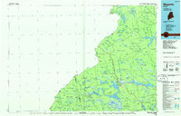
1986 Map of Megantic
USGS Topo · Published 1986About this map
The Canadian Pacific railroad corridor cuts across this remote Maine landscape, serving as the primary transit artery through the logging country of Somerset and Franklin Counties. The settlement of Jackman and the nearby Jackman Station anchor the region at the junction with U S 201, where the Jackman Mill represents the local industrial footprint. This mid-1980s data illustrates the interconnected waterway system essential to the timber industry, from the sprawling Canada Falls Lake to the meandering Moose River. Smaller outposts and plantation names like Dennistown, Lowelltown, and Dyer-ville provide a record of North Country habitation along the international border with Quebec. The topography is defined by the numerous water bodies, including Attean Pond, Wood Pond, and Holeb Pond, which are surrounded by peaks like Sally Mountain and Boundary Lookout along the height of land.
Find a feature on this map
184 named features on this map. Tap any name to fly to it.
Don’t see what you’re looking for? This feature index may not catch every label — zoom into the map to look around manually.
Map Details
Editions of this 1986 Megantic Map
This is the sole edition of this map. No revisions or reprints were ever made.
Other maps of this area

1905 · The Forks
USGS Topo · 1:62,500

1907 · The Forks
USGS Topo · 1:62,500

1921 · Brassua Lake
USGS Topo · 1:62,500

1922 · Long Pond
USGS Topo · 1:62,500

1923 · Brassua Lake
USGS Topo · 1:62,500

1923 · Attean
USGS Topo · 1:62,500

1924 · Long Pond
USGS Topo · 1:62,500

1925 · Pierce Pond
USGS Topo · 1:48,000

1925 · Attean
USGS Topo · 1:62,500

1927 · Sandy Bay
USGS Topo · 1:48,000