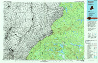
1994 Map of Megantic
USGS Topo · Published 1994About this map
The Canadian Pacific railway cuts through the dense timberlands of northwestern Somerset County, Maine, defining a landscape shaped by remote outposts and an intricate network of glacial lakes. In the early 1990s, Jackman served as the primary hub for this region, situated near the confluence of Wood Pond and the Moose River. The map highlights the sparse settlement pattern of the Maine North Woods, where small communities like Dennistown and Lowelltown provide access to the vast interior. This map also marks the international border, including the Port of Entry on Route 201, which connects this region to Quebec. The terrain is dominated by prominent peaks such as Attean Mountain and Sally Mountain, which overlook a series of interconnected water bodies including Attean Pond, Holeb Pond, and Long Pond, reflecting a landscape heavily utilized for both timber transport and recreational access.
Find a feature on this map
36 named features on this map. Tap any name to fly to it.
Don’t see what you’re looking for? This feature index may not catch every label — zoom into the map to look around manually.
Map Details
Editions of this 1994 Megantic Map
This is the sole edition of this map. No revisions or reprints were ever made.
Other maps of this area

1905 · The Forks
USGS Topo · 1:62,500

1907 · The Forks
USGS Topo · 1:62,500

1921 · Brassua Lake
USGS Topo · 1:62,500

1922 · Long Pond
USGS Topo · 1:62,500

1923 · Brassua Lake
USGS Topo · 1:62,500

1923 · Attean
USGS Topo · 1:62,500

1924 · Long Pond
USGS Topo · 1:62,500

1925 · Pierce Pond
USGS Topo · 1:48,000

1925 · Attean
USGS Topo · 1:62,500

1927 · Sandy Bay
USGS Topo · 1:48,000