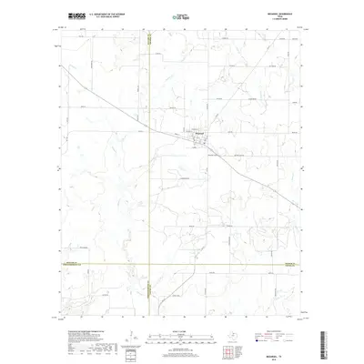
2019 Map of Megargel
USGS Topo · Published 2019About this map
Megargel serves as the central hub of this North Texas survey, situated at the unique intersection where Archer, Baylor, Throckmorton, and Young counties converge. The town's grid is clearly defined by streets such as St Marys St and Sycamore St, reflecting its layout in the years following the post-war era. The surrounding landscape is dominated by a complex network of ephemeral waterways, including Spring Creek and Kickapoo Creek, which drain the agricultural land toward the south and east.
Find a feature on this map
57 named features on this map. Tap any name to fly to it.
Don’t see what you’re looking for? This feature index may not catch every label — zoom into the map to look around manually.
Map Details
Editions of this 2019 Megargel Map
This is the sole edition of this map. No revisions or reprints were ever made.
Other maps of this area

1932 · Dundee
USGS Topo · 1:62,500

1954 · Wichita Falls
USGS Topo · 1:250,000

1958 · Wichita Falls
USGS Topo · 1:250,000

1963 · Dundee SW
USGS Topo · 1:24,000

1963 · Megargel
USGS Topo · 1:24,000

1964 · Padgett
USGS Topo · 1:24,000

1964 · Dundee SE
USGS Topo · 1:24,000
1964 · Lake Olney
USGS Topo · 1:24,000

1964 · Olney
USGS Topo · 1:24,000

1966 · Westover SE
USGS Topo · 1:24,000