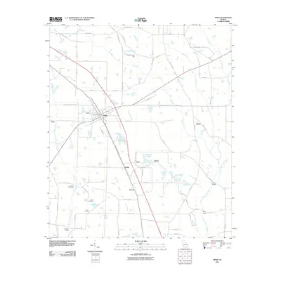
2011 Map of Meigs
USGS Topo · Published 2011About this map
Meigs sits at the heart of this Thomas County landscape, where the road network converges at the Meigs Post Office. The surrounding terrain is defined by a dense system of creeks and rivers, most notably the Little Ochlockonee River and Big Creek, which feed into numerous small ponds and reservoirs like Singletary Lake and Sevell Lake. Historical infrastructure is well-preserved in the labels, including family-named crossings such as Segler Mill Bridge, Brumbly Bridge, and Palmer Bridge. Genealogists will find a wealth of specific data across several burial grounds, including Sunset Cemetery, Midway Cemetery, and Providence Cemetery. The map also captures smaller named localities such as Quality and Hansell, connected by local thoroughfares like Nine Dime Doctor Rd and the historic Stage Coach Rd, illustrating the rural agricultural patterns of southern Georgia in the early 21st century.
Find a feature on this map
74 named features on this map. Tap any name to fly to it.
Don’t see what you’re looking for? This feature index may not catch every label — zoom into the map to look around manually.
Map Details
Editions of this 2011 Meigs Map
This is the sole edition of this map. No revisions or reprints were ever made.
Other maps of this area

1953 · Dothan
USGS Topo · 1:250,000

1953 · Waycross
USGS Topo · 1:250,000

1954 · Dothan
USGS Topo · 1:250,000

1954 · Valdosta
USGS Topo · 1:250,000

1954 · Tallahassee
USGS Topo · 1:250,000

1955 · Dothan
USGS Topo · 1:250,000

1956 · Cairo
USGS Topo · 1:62,500

1957 · Thomasville
USGS Topo · 1:62,500

1958 · Valdosta
USGS Topo · 1:250,000

1958 · Waycross
USGS Topo · 1:250,000