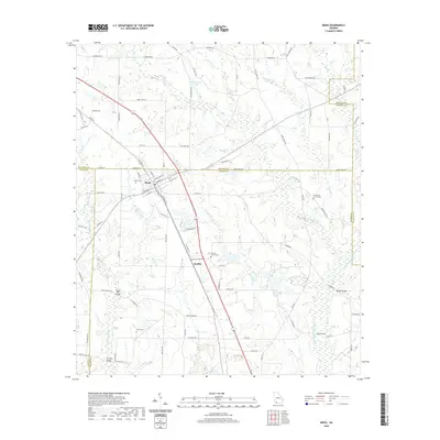
2020 Map of Meigs
USGS Topo · Published 2020About this map
Meigs sits at the intersection of five Georgia counties, a unique geographical positioning where the boundaries of Mitchell, Thomas, Grady, and Colquitt counties meet. The town's grid reflects its historical ties to the railroad, flanked by W Railroad St and E Railroad St, which parallel the main transit corridor. This 2020 update shows the persistent agricultural and riparian character of the South Georgia landscape, defined by a network of creeks and small lakes including Singletary Lake and Sevell Lake. Cultural sites such as Midway Church Cem and Providence Church Cem are scattered across the rural periphery, providing key landmarks for genealogical research. The map also documents specific local infrastructure like Segler Mill Bridge and Roup Bridge crossing the Little Ochlockonee River, illustrating how the modern road network follows historic water-crossing points in this multi-county region.
Find a feature on this map
92 named features on this map. Tap any name to fly to it.
Don’t see what you’re looking for? This feature index may not catch every label — zoom into the map to look around manually.
Map Details
Editions of this 2020 Meigs Map
This is the sole edition of this map. No revisions or reprints were ever made.
Other maps of this area

1953 · Dothan
USGS Topo · 1:250,000

1953 · Waycross
USGS Topo · 1:250,000

1954 · Dothan
USGS Topo · 1:250,000

1954 · Valdosta
USGS Topo · 1:250,000

1954 · Tallahassee
USGS Topo · 1:250,000

1955 · Dothan
USGS Topo · 1:250,000

1956 · Cairo
USGS Topo · 1:62,500

1957 · Thomasville
USGS Topo · 1:62,500

1958 · Valdosta
USGS Topo · 1:250,000

1958 · Waycross
USGS Topo · 1:250,000