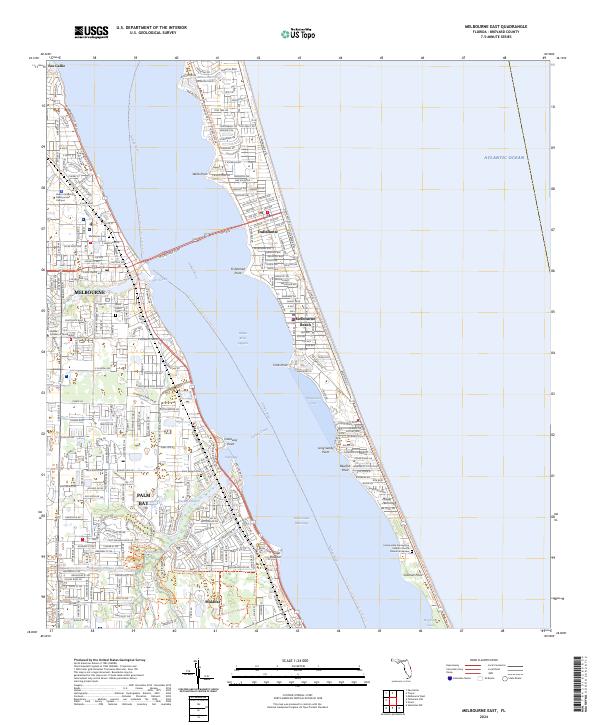
2024 Map of Melbourne East
USGS Topo · Published 2024About this map
The Indian River Lagoon and its corresponding section of the Intracoastal Waterway form the central axis of this coastal landscape, separating the mainland communities of Melbourne and Palm Bay from the barrier island towns of Indialantic and Melbourne Beach. The map details a sophisticated network of water and land trails, including the Florida Circumnavigational Paddling Trl and the East Coast Greenway Trl, reflecting the region's modern emphasis on conservation and recreation. Along the eastern shore, the Archie Carr National Wildlife Refuge stretches toward Coconut Point, protecting a vital coastal habitat. On the mainland, the residential growth of the 21st century is balanced by historical sites like the Melbourne Cem and Grant Street Cem, alongside institutional landmarks such as the Florida Institute of Technology. Deep inlets like Turkey Creek and Crane Creek reach into the suburban fabric, connecting the developed interior to the Atlantic coast.
Find a feature on this map
40 named features on this map. Tap any name to fly to it.
Don’t see what you’re looking for? This feature index may not catch every label — zoom into the map to look around manually.
Map Details
Editions of this 2024 Melbourne East Map
This is the sole edition of this map. No revisions or reprints were ever made.
Other maps of this area

1949 · Melbourne West
USGS Topo · 1:24,000

1949 · Melbourne East
USGS Topo · 1:24,000

1949 · Sebastian NW
USGS Topo · 1:24,000

1949 · Eau Gallie
USGS Topo · 1:24,000

1949 · Grant
USGS Topo · 1:24,000

1949 · Tropic
USGS Topo · 1:24,000

1951 · Sebastian NW
USGS Topo · 1:24,000

1951 · Melbourne East
USGS Topo · 1:24,000

1951 · Eau Gallie
USGS Topo · 1:24,000

1951 · Melbourne West
USGS Topo · 1:24,000