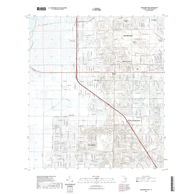
2021 Map of Melbourne West
USGS Topo · Published 2021About this map
Melbourne and the expanding residential corridors of Brevard County are the focus of this 2021 study. The landscape is characterized by a dense suburban grid that transitions into the western wetlands of the Saint Johns Marsh and the Saint Johns River. A significant portion of the central terrain is occupied by the Melbourne International Airport, which serves as a major logistical hub for the region.
Find a feature on this map
105 named features on this map. Tap any name to fly to it.
Don’t see what you’re looking for? This feature index may not catch every label — zoom into the map to look around manually.
Map Details
Editions of this 2021 Melbourne West Map
This is the sole edition of this map. No revisions or reprints were ever made.
Other maps of this area

1949 · Melbourne West
USGS Topo · 1:24,000

1949 · Melbourne East
USGS Topo · 1:24,000

1949 · Eau Gallie
USGS Topo · 1:24,000

1949 · Grant
USGS Topo · 1:24,000

1949 · Tropic
USGS Topo · 1:24,000

1951 · Melbourne East
USGS Topo · 1:24,000

1951 · Eau Gallie
USGS Topo · 1:24,000

1951 · Melbourne West
USGS Topo · 1:24,000

1951 · Grant
USGS Topo · 1:24,000
1951 · Tropic
USGS Topo · 1:24,000