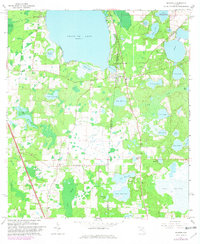
1966 Map of Melrose
USGS Topo · Published 1981About this map
Melrose sits at the nexus of four counties in this 1960s landscape, positioned where the borders of Alachua, Bradford, Clay, and Putnam meet along the shores of Melrose Bay. The map reveals a region defined by its expansive water bodies and low-lying wetlands, dominated by the massive Santa Fe Lake and the marshy expanse of Levys Prairie. Small rural settlements like Earleton, Beckhamtown, and Campville are connected by a network of roads and the tracks of the Seaboard Coast Line railroad, which cuts through the southwestern corner.
Find a feature on this map
49 named features on this map. Tap any name to fly to it.
Don’t see what you’re looking for? This feature index may not catch every label — zoom into the map to look around manually.
Map Details
Editions of this 1966 Melrose Map
3 editions found
Other maps of this area

1915 · Interlachen
USGS Topo · 1:48,000

1916 · Interlachen
USGS Topo · 1:62,500

1938 · Hawthorn
USGS Topo · 1:48,000

1941 · Starke
USGS Topo · 1:62,500

1942 · Ates Creek
USGS Topo · 1:62,500

1943 · Hawthorn
USGS Topo · 1:62,500

1944 · Interlachen
USGS Topo · 1:62,500

1948 · Starke
USGS Topo · 1:50,000

1949 · Keuka
USGS Topo · 1:24,000

1949 · Gold Head Branch
USGS Topo · 1:24,000