
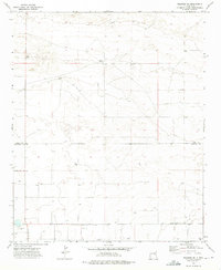
1972 Map of Melrose East
USGS Topo · Published 1975About this map
Melrose serves as the primary hub of this high plains landscape in Curry County, where the settlement's western edge meets the extensive rail corridor of the Atchison Topeka and Santa Fe. The town's local infrastructure is clearly defined, including the Memorial Cem and a dedicated Rodeo Ground situated near the railroad tracks. Beyond the town, the terrain is marked by the industrial footprints of several Gravel Pit operations and a Sandpit, reflecting the area's mineral resource extraction. The map also documents modern utility and exploration markers, such as a Radio Tower and a specific Drill Hole. Large-scale property divisions are represented by a network of fence lines, illustrating the ranching and agricultural character of the region during the early 1970s.
Find a feature on this map
8 named features on this map. Tap any name to fly to it.
Don’t see what you’re looking for? This feature index may not catch every label — zoom into the map to look around manually.
Map Details
Editions of this 1972 Melrose East Map
This is the sole edition of this map. No revisions or reprints were ever made.
Other maps of this area

1954 · Clovis
USGS Topo · 1:250,000

1957 · Portair
USGS Topo · 1:62,500

1957 · Melrose
USGS Topo · 1:62,500

1957 · Hammond Ranch
USGS Topo · 1:62,500

1958 · Clovis
USGS Topo · 1:250,000

1973 · Field SE
USGS Topo · 1:24,000

1973 · Melrose West
USGS Topo · 1:24,000

1973 · Tule Lake
USGS Topo · 1:24,000

1973 · Field SW
USGS Topo · 1:24,000
1973 · Melrose SE
USGS Topo · 1:24,000