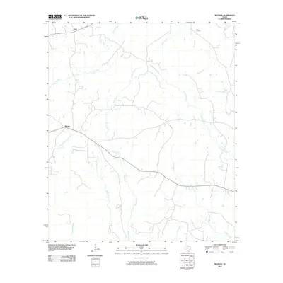
2010 Map of Melrose
USGS Topo · Published 2010About this map
Swift and Melrose anchor this 2010 depiction of the East Texas landscape, where the dendritic drainage patterns of the Neches and Angelina river basins define the local topography. This area is characterized by a dense network of tributaries, including Moss Creek and Amaladeros Creek, which cut through the region's undulating terrain. For those investigating the cultural history of Nacogdoches County, the presence of the Pilgrim Cemetery near the northern boundary provides a specific point of reference for genealogical research.
Find a feature on this map
16 named features on this map. Tap any name to fly to it.
Don’t see what you’re looking for? This feature index may not catch every label — zoom into the map to look around manually.
Map Details
Editions of this 2010 Melrose Map
This is the sole edition of this map. No revisions or reprints were ever made.
Other maps of this area

1949 · Lufkin
USGS Topo · 1:62,500

1949 · Platt
USGS Topo · 1:24,000

1950 · Platt
USGS Topo · 1:24,000

1952 · Nacogdoches
USGS Topo · 1:62,500

1953 · Palestine
USGS Topo · 1:250,000

1957 · Palestine
USGS Topo · 1:250,000

1958 · Broaddus
USGS Topo · 1:62,500

1958 · Martinsville
USGS Topo · 1:62,500
1983 · Woden
USGS Topo · 1:24,000
1983 · Appleby
USGS Topo · 1:24,000