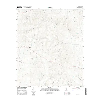
2016 Map of Melrose
USGS Topo · Published 2016About this map
The community of Melrose and the smaller settlement of Swift anchor this portion of Nacogdoches County, defined by a landscape of creeks and historical transportation corridors. One of the most significant features is the route of El Camino Real, which cuts diagonally across the southern half of the map, tracing an ancient path that linked early Texas settlements. This historic artery remains a prominent fixture alongside local roads like Melrose Blackjack Rd and Jamesville Rd.
Find a feature on this map
59 named features on this map. Tap any name to fly to it.
Don’t see what you’re looking for? This feature index may not catch every label — zoom into the map to look around manually.
Map Details
Editions of this 2016 Melrose Map
This is the sole edition of this map. No revisions or reprints were ever made.
Other maps of this area

1949 · Lufkin
USGS Topo · 1:62,500

1949 · Platt
USGS Topo · 1:24,000

1950 · Platt
USGS Topo · 1:24,000

1952 · Nacogdoches
USGS Topo · 1:62,500

1953 · Palestine
USGS Topo · 1:250,000

1957 · Palestine
USGS Topo · 1:250,000

1958 · Broaddus
USGS Topo · 1:62,500

1958 · Martinsville
USGS Topo · 1:62,500
1983 · Woden
USGS Topo · 1:24,000
1983 · Appleby
USGS Topo · 1:24,000