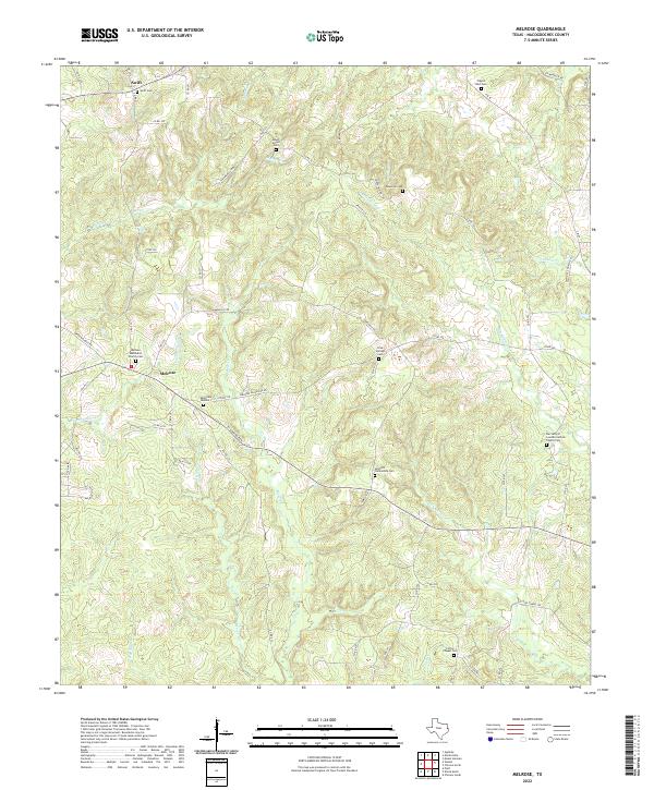
2022 Map of Melrose
USGS Topo · Published 2022About this map
Melrose and Swift anchor this portion of Nacogdoches County, where the landscape is defined by a dense network of creek drainages including Amaladeros Cr, Puenta Suelas Cr, and Moss Cr. The map highlights a significant genealogical record through its numerous small burial grounds and rural congregations. Places such as the Melrose Methodist Church Cem, Sand Hill Community Cem, and the secluded Mount Gillion Cem suggest a long-established pattern of family-centered settlement across the rolling terrain.
Find a feature on this map
67 named features on this map. Tap any name to fly to it.
Don’t see what you’re looking for? This feature index may not catch every label — zoom into the map to look around manually.
Map Details
Editions of this 2022 Melrose Map
This is the sole edition of this map. No revisions or reprints were ever made.
Other maps of this area

1949 · Lufkin
USGS Topo · 1:62,500

1949 · Platt
USGS Topo · 1:24,000

1950 · Platt
USGS Topo · 1:24,000

1952 · Nacogdoches
USGS Topo · 1:62,500

1953 · Palestine
USGS Topo · 1:250,000

1957 · Palestine
USGS Topo · 1:250,000

1958 · Broaddus
USGS Topo · 1:62,500

1958 · Martinsville
USGS Topo · 1:62,500
1983 · Woden
USGS Topo · 1:24,000
1983 · Appleby
USGS Topo · 1:24,000