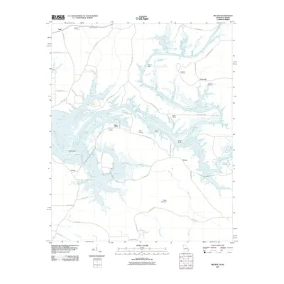
2011 Map of Melson
USGS Topo · Published 2011About this map
Weiss Lake dominates this 2011 survey, its finger-like bays and inlets reaching into the Georgia and Alabama borderlands. The intricate shoreline, formed by the impoundment of the Coosa River, has transformed the local geography into a landscape of peninsulas and river bends, including Morton Bend, Foster Bend, and Wrights Bend. Amidst this water-bound terrain, several historic family and community burial grounds remain, such as Hardman Cemetery and Salem Cemetery near Farill, and Macedonia Cemetery north of Anniedelle. These sites, along with Potash Landing, serve as markers of the area's older agricultural and river-based settlement patterns.
Find a feature on this map
61 named features on this map. Tap any name to fly to it.
Don’t see what you’re looking for? This feature index may not catch every label — zoom into the map to look around manually.
Map Details
Editions of this 2011 Melson Map
This is the sole edition of this map. No revisions or reprints were ever made.
Other maps of this area

1886 · Rome
USGS Topo · 1:125,000

1893 · Fort Payne
USGS Topo · 1:125,000

1898 · Rome
USGS Topo · 1:125,000

1898 · Fort Payne
USGS Topo · 1:125,000

1899 · Rome
USGS Topo · 1:125,000

1900 · Fort Payne
USGS Topo · 1:125,000

1904 · Rome
USGS Topo · 1:125,000

1955 · Rome
USGS Topo · 1:250,000

1958 · Rome
USGS Topo · 1:250,000

1961 · Rome
USGS Topo · 1:250,000