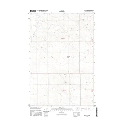
2017 Map of Melstone NW
USGS Topo · Published 2017About this map
Wilson Coulee and Butts Coulee drain the high plains of Musselshell County in this topographic representation of the Montana landscape. The area is defined by a complex network of coulees, including Seventynine Coulee and West Keggy Coulee, which create a deeply incised terrain characteristic of this part of the state. Water features are sparse but significant, centered on Willow Cr and its northern branch, N Willow Cr. The map captures the rural infrastructure of the early 21st century, showing how modern corridors like Ragged Point Rd and N Melstone Rd follow the natural topography. This section of the county is primarily organized by the Public Land Survey System, with the boundaries of t11n r30e and surrounding townships clearly delineating the vast, open rangeland between the scattered drainage basins.
Find a feature on this map
15 named features on this map. Tap any name to fly to it.
Don’t see what you’re looking for? This feature index may not catch every label — zoom into the map to look around manually.
Map Details
Editions of this 2017 Melstone NW Map
This is the sole edition of this map. No revisions or reprints were ever made.
Other maps of this area

1954 · Forsyth
USGS Topo · 1:250,000

1954 · Roundup
USGS Topo · 1:250,000

1957 · Forsyth
USGS Topo · 1:250,000

1958 · Roundup
USGS Topo · 1:250,000

1958 · Forsyth
USGS Topo · 1:250,000

1962 · Queens Point
USGS Topo · 1:24,000

1962 · Melstone NE
USGS Topo · 1:24,000

1962 · Maxwell Ranch
USGS Topo · 1:24,000

1962 · Melstone NW
USGS Topo · 1:24,000

1962 · Mosby SE
USGS Topo · 1:24,000