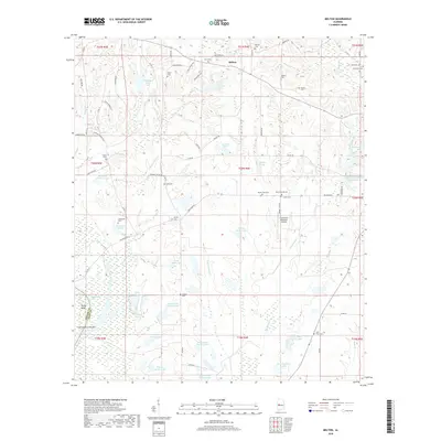
2018 Map of Melton
USGS Topo · Published 2018About this map
Melton sits at the heart of this Hale County landscape, where the rural topography is defined by an intricate network of family cemeteries and managed waterways. Numerous burial grounds, including Saint Pauls Cem, Mount Zion Cem, and Martian Cem, are scattered across the terrain, reflecting the deep-rooted genealogical history of the area. The map illustrates a transition from the rolling hills in the north to the low-lying wetlands and bend of the Black Warrior River system at Duffys Bend. Extensive water features such as Limestone Lakes, Sullivan Lakes, and the State Cattle Ranch Lakes suggest a landscape heavily utilized for agriculture and aquaculture. The inclusion of the Greensboro Municipal Airport and the boundary between Greene Co and Hale Co provides clear orientation for modern and historical geographic research.
Find a feature on this map
100 named features on this map. Tap any name to fly to it.
Don’t see what you’re looking for? This feature index may not catch every label — zoom into the map to look around manually.
Map Details
Editions of this 2018 Melton Map
This is the sole edition of this map. No revisions or reprints were ever made.
Other maps of this area

1927 · Eutaw
USGS Topo · 1:48,000

1931 · Eutaw
USGS Topo · 1:62,500

1946 · Demopolis
USGS Topo · 1:24,000

1947 · Demopolis
USGS Topo · 1:24,000

1947 · Mason Bend
USGS Topo · 1:24,000

1948 · Mason Bend
USGS Topo · 1:24,000

1953 · Montgomery
USGS Topo · 1:250,000

1956 · Montgomery
USGS Topo · 1:250,000

1957 · Montgomery
USGS Topo · 1:250,000

1979 · Greensboro
USGS Topo · 1:24,000